Current Temperature

CHICAGO WEATHER
Showing posts with label 10th ward. Show all posts

Tuesday, September 6, 2022

CBS 2: 13 members of the city council are leaving


[VIDEO] And more to come reportedly according to this report. The latest Alderman to announce she won't run for re-election is Ward 10 Ald. Susan Sadlowski Garza. You can read more about it at Crain's.

You can check out this list also from Crain's in August the Alderman who are calling it quits, some are trying to attain higher office as three Alderman are looking to challenge Mayor Lori Lightfoot. Others are outright retiring also.

Portrayed as a mass exodus, I'd pay attention if half of the 50 members of the city council are leaving.

Sunday, May 29, 2022

Sun-Times: Ward map battle over, but bitterness lingers

As stated already Altgeld Gardens will soon be in Ward 10 it is especially noted in this Chicago Sun-Times May 16, 2022 article. Altgeld Gardens is currently in Ward 9

Wednesday, May 11, 2022

Sun-Times: Compromise on new City Council ward map could take issue away from Chicago voters

 The vote on this new map will take place when the City Council meets next week. You can check out what the ward remap looks like here.

From Sun-Times:

A deal has been struck on a new Chicago City Council ward map that, if approved, will keep the decision out of the hands of voters.

Under the deal, which still must be cemented by a City Council vote next week, the map will create 16 Black majority wards and 14 Latino majority wards, according to Ald. George Cardenas (12th).

Faced with a May 19 deadline to work it out themselves, the agreement calls for one fewer majority-Latino ward than the council’s Latino Caucus had wanted.

The proposed map also contains the city’s first ward with an Asian American majority.

Demographics are key to ward map negotiations. The city’s Black population is shrinking while the city’s Latino population is growing.

“There’s no need to bring the house down. We can own the house,” Cardenas said, referring to the next remap — in 10 years.

“Our day is coming for sure. We have to be patient and humble,” he said.

Cardenas offered a “kudos” to Mayor Lori Lightfoot for her work on Monday to facilitate the agreement and get all sides to sign on to the map.

Cardenas is grateful the map won’t go to a referendum — a step that, he said, would have siphoned energy from council members dealing with other pressing issues, including crime and a city casino.

Here's how our part of town looks in the new ward map. If you live in Altgeld Gardens, that development will now be in Ward 10.


Friday, April 29, 2022

Chicago Mag: ‘This is the end of Chicago’ (Geographically)

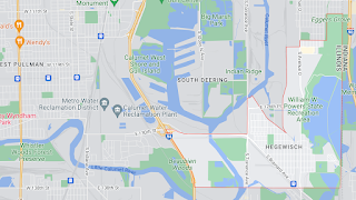
Map of Hegewisch and nearby area 

From Ed McClelland at Chicago Magazine regarding the southeast side of Chicago.

To reach the southeasternmost corner of Chicago, you have to take bumpy, potholed Boy Scout Road out of Hegewisch, then turn onto a set of tracks belonging to the Indiana Harbor Belt Railroad. With Powder Horn Lake to your right, follow the tracks between tall stands of reeds, still in their winter blondeness, toward a railyard where black tankers idle. Then turn onto a disused rail spur, weeds growing between its ties. Ahead, just across the state line, in Hammond, Indiana, are the rusted sheds of some long-abandoned industrial concern.

Chicago’s southern border is, perhaps, the wildest, most undeveloped part of the city, a hinterland that, in some places, looks more rural than urban, despite lying within the boundaries of America’s third-largest city. Like the nation’s southern frontier, it is a no-man’s land that crosses woods, lakes, rivers, and federal facilities off limits to the public. It would have made sense to set the southern city limits at the Little Calumet and Grand Calumet rivers. Instead of respecting natural boundaries, though, surveyors drew a straight line that corresponds with the middle of 138th Street and is often impossible to follow, even by bicycle or on foot. Last weekend, I tried, and, for most of its length, I failed.

After leaving the Belt Railroad yards, the city limits travel west across Powder Horn Lake and through Burnham Woods. I only had a bicycle, not a canoe or a machete, so I couldn’t paddle and bushwhack through those wild barriers. To pick up the line again, I pedaled south to the village of Burnham, and into the dirt alley behind 138th Place, a street of vinyl-sided workers’ cottages and a long-shuttered Old Style bar. Running along the north side of the alley is a fence entangled with vines — a border fence between the city and suburbs, as flimsy as any in the Sonoran Desert, barring the way to Mexico. On the other side is Chicago.

The alley dead ends near the south bank of the Grand Calumet River, the body of water that lends its name to the Calumet Region. From there, the city limits cross the confluence of the Grand and Little Calumets. When they hit land again, they slice through the northern tip of Burnham Park. A few square feet of that suburban park actually lies inside Chicago, although the village of Burnham still mows the grass. Such is what happens when man’s Euclidean determinations impose themselves on nature’s beguiling irregularities.

They go from about Altgeld Gardens which is contained within Ward 9 and further east into the area known as Hegewisch as you see in the above map. Read the whole thing.